Pawtuckaway State Park: Its Creation Story
Stephen Soreff, MD
Introduction
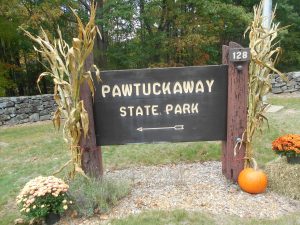
Pawtuckaway Lake and Pawtuckaway State Park represent one of the greatest jewels in New Hampshire’s crown of unique, accessible, recreational wilderness landscapes. I live on Pawtuckaway Lake and daily enjoy the lake as my front lawn and marvel at the majesty and glory of my neighbor Pawtuckaway State Park. As I kayaked its waters, I got to wondering how the lake and this State Park came into being. My curiosity was further stirred as I met ‘locals’ who witnessed the Park’s construction. This story is my answer to ho
w the Pawtuckaway Lake and Mountains and the State Park happened.
The region at a time before time: Its geologic origins
“Geography is destiny.” Abraham Verghese, from Cutting for Stone.
Although the origin of our earth only goes back to about 4.6 billion years compared to the birth of the universe at about 15 billion, let us start with 355 million years ago when a great inland sea covered the Pawtuckaway area. (Freedman, 1980) This resulted in major deposits on the ocean floor which would become sedimentary rock formations. Ultimately, as the land rose the sea disappeared in the late Devonian time period. The Devonian Period was approximately 330 million years ago. These sedimentary rocks would be subjected to pressure and folding which recrystallized this sheet of sedimentary into mica, schist, quartzite, and actinolite granulite. (Freedman, 1980) Over time erosion through wind and rain would alter and degrade these formations.
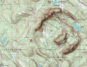
Then in the Mississippian Period, magma – igneous rock – also called the White Mountain magma series – intruded itself into the overlying formations. This period occurred approximately 290 million years ago. These intrusions would lead to the formation of the Pawtuckaway Mountains. Indeed, the South, Middle and North Pawtuckaway Mountains were formed by magma intrusions called dikes.
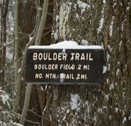
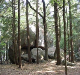
The next big geologic event occurred two million years ago with the Great Ice Age. Although there were four periods of glaciations, the last one occurred about 50,000 years ago. Then, a wall of ice a mile high sculpted the landscape. It left scratches in the underlying rocks it traveled over called Glacial striations. And more to our story, the glaciers deposited huge boulders on the land as well as in the area which would be ultimately covered by Pawtuckaway Lake. Such a deposit is called a glacial erratic. The Boulder Field of Pawtuckaway State Park offers testimony to this glacial visitation.
Long ago people occupied the region, in the area now geographically called the Pawtuckaway Basin, which was indeed a place where water was collected. This was because water moves from higher areas to lower levels via a series of streams and brooks. On the north end, the waters from these tributaries flowed into what we now call the North River. On the south end, water from Mountain Brook and other streams entered into small pools. In turn, these pools drained into what is now called the Pawtuckaway River, also known as the Stingy River. Ultimately, the North River and Pawtuckaway River joined the Lamprey River. The Lamprey empties into Great Bay and the Atlantic Ocean.
The first people
Small groups of Native Americans belonging to the Penacook Confederacy inhabited the area around Pawtuckaway. They were part of the larger Algonquin Division that covered northeastern America. Reportedly, they were mild-mannered people, influenced by the colonization of the French as well as the English. Their leader, Passaconnaway, was said to be a peaceful man.
Native Americans are credited with the origin of the lake’s name, Pawtuckaway. Depending on the source, there are a number of competing answers as to the derivation of Pawtuckaway. One says Pawtuckaway came from the Algonquin language meaning the “Place of the Big Buck”. Another notes that the Native Americans called the area of Pawtuckaway “land of sticks and stones”, which nicely applies to the region of the lake, as it was not considered fit for farming. Finally, a third possibility is that Pawtuckaway is derived from the Native American term for “the falls in the river”.
The second people
There were few settlers in the region during the colonial periods and after the American Revolution. There were two water-driven sawmills. These reflected the beginning of lumbering as a local industry. (Williams, 2005) One was at the Pawtuckaway River near where the stream crosses the modern Route 156 today. This was a grist and sawmill built by a gentleman named Dolloff who had German heritage. The other was operated by Shem Browne as both a saw and gristmill near where the North River flows from the present Drowns Dam area. Smoke Street boasted charcoal production. And there were farms and homes around Nottingham Square.
Dams change the natural landscape and set the stage for the next phase
But the dams would change all that and provide the pivotal events ultimately resulting in the creation of the State Park. Remember Nottingham was historically a remote, quiet village without major industries. Its population reflected that. The 1940 Census showed the Town’s population to be 468 and the 1950 Census, 566. (New Hampshire Census, 2016) A member of the Daughters of the American Revolution, Else Cilley Chapter, in Nottingham, once remarked that there were more sheep than people in town.
In our era of steam and gasoline engines and electricity, it remains difficult to appreciate that water used to be the only way to power machines. That accounts for why New England with its mighty rivers such as the Merrimack came to be such a dominant industrial empire. Newmarket had a number of textile factories. Water powered the looms. In fact, a consistent source of water was an economic necessity.
So quietly, in the early 1820’s the Newmarket Manufacturing Company purchased land and flood zones in the area. Its goal through this acquisition was to gain parcels on which to build two dams. This purchasing program allowed for a patchwork pattern of both private and company property. So in 1836 the company constructed two dams – Dolloff and Drowns. Dolloff Dam was constructed of huge granite blocks. Each dam created its own artificial pond. The Drowns Dam resulted in the Pawtuckaway Pond and the Dolloff Dam led to the Dolloff Pond. Together the two ponds accounted for about 802 acres. The company also dug a dike at Seaman’s Point called the Gove Dike. This was designed to contain any overflow from the ponds so that excess water would not flow onto private property. The dams were destined to create Pawtuckaway Lake.
Meanwhile the other Pawtuckaway, the Pawtuckaway Mountains
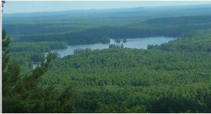
Remember for the region’s geographic history, there are two different types of terrains: the wet lowlands destined to become the ponds and the mountains created by the magma dikes. In 1912 the State of New Hampshire recognized that the forests around Pawtuckaway represented an important economic Resources which needed to be protected. So, it constructed a 24 foot high Fire Lookout Tower on top of South Pawtuckaway Mountain in 1913. This was the State’s first steel fire tower. (Baird, 205) Incidentally, the tower resulted from the Weeks Act of 1913. That Act created the White Mountains National Forest. In turn, that freed up state forest fire prevention funds for other activities, since New Hampshire was no longer responsible for that vast area. The tower was located on the “Deerfield-Raymond road to Goodrich House ½ trail”. (DRED)
The State started to purchase land in the mountain area beginning in 1923. In July, 1923 the State bought 60 acres in the Middle Pawtuckaway area. Next in March,1924 the widow of George W. Goodrich sold to the State 100 acres of the family farm in the South Pawtuckaway Mountain section. This was followed by another acquisition in June,1924. Miss Caroline A. Fox of Hillsboro, New Hampshire and her sister Mrs. Alice F. Cochran from New Haven, Connecticut bought 450 acres as part of the Chase farm and donated it to the State. This gift included the Boulder Fields. Still later the State purchased another 150 acres. This encompassed the Devil’s Den region. At this point the State had secured 760 acres. Finally, Rockingham County sold the State another 158 acres, bringing the total to 918 acres which constituted the Pawtuckaway Reservation. The Reservation was destined to be part of the future of the State Park.
As a sad note, the mountain area made the news in 1944 when a B-24 plane, a Liberator bomber, crashed into the base of the Middle Mountain. (Crash, 1944) The accident occurred on the Wednesday morning of November 29, 1944. The entire crew of nine airmen perished in the crash. The plane was en route to Europe.
The Dams change hands twice
However, textile manufacturing was changing and moving south. As a result of a strike at the Newmarket Manufacturing Company in 1920, the company relocated its textile manufacturing to the southern states. Meanwhile, the regional and national manufacturing power source was shifting from water power to steam and electricity. Coinciding with these changes, the Newmarket Manufacturing Company transferred its interest in Pawtuckaway Lake’s dams and properties to the New Hampshire Electric Company in 1946. The term ‘interest’ here encompasses about 800 water acres along with shore frontage, two dams, and one dike. The dams controlled the water levels and flowage. Perhaps as one more barometer of these alterations, the Newmarket Manufacturing Company consolidated its business in Lowell, Massachusetts.
However, by then the Electric Company found that the generation of electricity proved to be unprofitable. The dams’ sole role was to maintain Dolloff and Pawtuckaway Ponds as a source of its power. Thus, the company decided to divest itself of the dams and their properties. It put its lake holdings up for both sale and auction. In fact, several of the lake residents can trace their acquisition back to purchasing it directly from the New Hampshire Electric Company. As a result of the auction, Hans Brustle, a famous wood carver and resident of the Pawtuckaway shores area bid on and won the acreage between Mountain Brook and Neal’s Cove. Hans was also at one time the President of the Pawtuckaway Lake Improvement Association (PLIA).
Incidentally, the PLIA had many discussions and conflicts with New Hampshire Electric Company concerning the lake’s water levels. Moreover, Hans knew Judge Herbert Grinnell from Derry, New Hampshire. Judge Grinnell would prove to be one of the key movers behind the scenes in the creation of the State Park. As R. C. Whitney wrote, “ Hans Brustle knew Judge George Grinnell (Derry, NH) and called him for help to get the State of NH to purchase the NE Elec. Land”.
Finally, the Electric Company offered them to the Town of Nottingham. However, according to Compton’s history, the Town’s Selectmen rejected the offer without any local vote on the issue. With all those options exhausted on December 28, 1955, the New Hampshire Electric Company passed its interest in the area to the State of New Hampshire. “These interests consisted of approximately 820 acres of land with considerable shore frontage on the Lake; two dams and a dike for controlling the water level; and the flowage, drainage, and other riparian rights owned by the Company (A Plan for the Development of the State Property at Pawtuckaway Lake, 1958)
Recorded deeds capture the series of transactions resulting in the State acquisition of the area. “New Market Manufacturing Co to Lamprey River Improvement Co. 3/13/16 Book 706 Page 72. Quitclaim deed from Lamprey River Improvement Co to NH Gas and Electric 1/15/46 Book 1043 Page 17. A transfer from NH G&E to NH Electric. Quitclaim deed from NH Electric Co. to State of NH, Water Resources Board, 12/28/55 Book 1388 Page 433. NH Governor and Council transfer from Water Resources Board to DRED Dec 6, 1962” (see Book 1654 page 385).
The George Herbert Grinnell story
In tracing the history of Pawtuckaway State Park, one name always comes up, George Herbert Grinnell. Yet, it does not appear in the formal pertinent documents. On the other hand, many of the people instrumental in the creation of the State Park, like John Perkins, Mary Louis Hancock and Russell Tobey, are clearly documented and recorded. But in the oral histories and the scraps of paper in Nottingham’s Historical Society (NHS) notebooks devoted to the Park, the name of George Herbert Grinnell repeatedly appears. His influence was behind the scenes.
George Herbert Grinnell was a very well-known personality around the Pawtuckaway area and in my hometown, Derry, New Hampshire. Here is an example of how his name would come up. Around the time the NH Electric Company was trying to sell off and auction its Pawtuckaway properties, a sheet of paper in the NHS’s Pawtuckaway folder says: “Hans [a President of the Pawtuckaway Lake Improvement Association, a lake dweller and one of the auction bidders] knew George Grinnell (Derry, NH) and called him for help to get the State of NH to purchase the balance of the Elec. Land.”
Who was George Herbert Grinnell? And how did he play such a prominent role in the creation of the State Park? He entered the world on April 21, 1910 via his parents Herbert and Jenny Grinnell in Derry, NH. He has been described with a “masculine zest for life and athletic prowess”. ( Batchelder, 1995) He attended Pinkerton Academy, was an undergraduate at the University of New Hampshire, and earned a law degree from Boston University Law School. In World War II he served in the Coast Artillery Corp and joined his father in practicing law in Derry. He later followed his father as the Justice of the Derry District Court. He died on June 16, 2000.
He was known as the “flying judge’ and was instrumental in getting legislation through that allowed seaplanes to be able to land on any of New Hampshire’s lakes. He loved to fly although he crashed his aircraft four times, once into Pawtuckaway Lake. In addition to his major interest in aviation he cared about horses and horse racing. He served as a member of the State Racing Commission. He was also Derry’s Town Moderator and a Deputy Forest Fire Warden. He was the President of the Merrimack Valley Region Association which functioned to promote tourism in the southern central area of New Hampshire.
This author trusts that by all these accomplishments, the reader gains a sense of Judge Grinnell as an extremely active and civically engaged person. He married Harriet in 1942 and they had two daughters, Susan and Hannah. He owned property on Pawtuckaway. He was a mover and shaker. For example, in an interview of Gladys Whitney by Jeff Gurrier about her experiences in the early days of Pawtuckaway Lake, she said, “There was still a big chunk of land left up for grabs. Hans Brustle, Jon White’s grandfather, and Judge Grinnell went up to the State and encouraged them to take that land for a State Park. They kept working that until the State eventually bought the land. Judge Grinnell was a District Court judge in Derry, he had some clout. He was a big part of getting the State Park through up in Concord.”
Yet, in interviews by the author with his two daughters and his grandson as to how he achieved these successes in Concord, they could not account for his accomplishments. But note this statement which appears in an unknown author’s note in a Pawtuckaway State Park folder at the Nottingham Historical Society: “From the moment that Judge George Grinnell of Derry, NH (as President of the Merrimac Valley Region Association in the ’40s), aided and supported by various members of the Pawtuckaway Lake Improvement Association endorsed and supported the acquisition of Big Island, the dams, and the lake by the State of NH. The coming of the Park in that area has been merely a question of time. The enabling legislation sponsored by John A. Perkins was a good attempt (not yet lost) to turn the developing situation to the immediate benefit of the town.” (What about the state park)
Now that the State has the property, what to do with it?
With the State’s acquisition of the land, the dams, and the lake, an army of questions and concerns emerged. What would be the status of the many camps developed on the shore frontage? Who would regulate the dams? And what should the state ultimately do with these 802 acres? A glance at the Town of Nottingham’s Annual Report for 1957 illustrates the competing stakeholders’ positions.
At the March, 1957, Town Meeting:
“certain articles in the warrant dealt with the subject of state-owned lands in the Pawtuckaway area. Title to these now rests with the State Water Resources Board which pays no tax, not even the small reimbursement made by the state on lands held by other state departments. Your Selectmen, acting with and through your legislative representative, first acted with the hope of having title to these lands transferred to the town. Opposition to transfer developed from both the Water Resources Board, which was unwilling to give up its rights unless it also could turn over its responsibility for the Pawtuckaway dams; and from the Pawtuckaway Lake Improvement Association, which objected on the ground principally that privately owned shore developments now opened should not be forced to compete with publicly owned property”
(Town of Nottingham, NH Annual Report, 1957)
To address these issues and concerns, John Perkins, Nottingham’s Representative to the New Hampshire House, introduced House Bill No. 297 in 1957. It stated, “An Act relative to conveyance of land to the town of Nottingham. Whereas, on December 28, 1955 the New Hampshire Electric Company conveyed certain land and other property in Nottingham to the State of New Hampshire …Whereas, as a result of said conveyance the town of Nottingham has been deprived of a substantial portion of taxable property; and Whereas, the town of Nottingham desires to acquire said property and to develop it and restore it to the status of privately owned property subject to taxation…” This legislative initiative had far-reaching consequences.
Although the Bill’s intent seemed to focus on regaining taxable properties, John Perkins had other goals. According to an interview of John Perkins’s son by the author, John was concerned about Nottingham’s remoteness and its lack of industries. He sought more opportunities for the Town from the State’s land.
The legislative process can be convoluted and complex. As a result of Perkins’s House Bill No. 297, the “1957 General Court, by Chapter 318, Laws of 1957, directed the State Planning and Development Commission to…make a study of the most expeditious means of opening this area for development by either the state, the town of Nottingham, or private parties, or a combination of any of same so as to provide to the town concerned, public access to the lake for general recreational use, and utilization of such part of the area for other state departments as may be necessary or desirable”. (A Plan, Introduction)
This legislative initiative marks the turning point in the history of the creation of the State Park. The State acquisition of the Pawtuckaway Basin created an economic and political vacuum. A simple act by John Perkins for Nottingham to recover lost tax revenue through a legislative process resulted in “a study of the most expeditious means of opening this area for development.” That study served as a milestone in the process, setting the stage for the creation of Pawtuckaway State Park.
As a postscript to this legislative journey, lest the intent of Perkins’s original Bill No. 297 get lost in the process, in 1960 House Resolution 27 introduced by Mr. Kelsey provided a “Joint Resolution to reimburse the town of Nottingham for the tax revenue lost through land taking by the State for Pawtuckaway State Park.”
The Study
When the “1957 General Court, by Chapter 318, Laws of 1957, directed the State Planning and Development Commission to…make a study of the most expeditious means of opening this area for development”, it set in motion an organized but not funded exploration of the options and possibilities for the acquired land. It also highlighted the competing interests involved and led to the August 1958 report entitled, “A Plan for the Development of the State Property at Pawtuckaway Lake”. This would be the first of the three state reports issued concerning the development of the Park.
There were many competing interests and concerns. The Town of Nottingham wanted a beach and a picnic area as well as a method to recover lost tax revenue. Fishermen and the Fish and Game Department sought a place to fish. The Water Resources Board desired access roads and an avenue to sell land for private ownership. The Dam Bureau was concerned about the two dams – their operation and maintenance. Many citizens wished to purchase waterfront property. The State yearned for more recreation opportunities for both its residents and out-of-state tourists. As the Report noted, 52 % of the entire New Hampshire population lived within 31 miles of the park. (A Plan, 1958)
What did the August 1958 study find? (A Plan, 1958) There should be within the Pawtuckaway area a place for a Nottingham Town beach and picnic area. The Park should have three public access points at Dolloff Dam, Drowns Dam, and the Bay of Fundy. The Park should contain a primitive wilderness area. The State through the Governor and Council should authorize funds to develop the Pawtuckaway Basin with access and internal roads. The Town of Nottingham could sell shorefront lots and other land to gain taxable properties. It noted the growing importance of the Big Island with the State both selling some properties and purchasing others. There should be private property on Neal’s Cove. There should be a corridor established connecting the Park and the Reservation. And finally, Nottingham needed to craft a zoning ordinance allowing for private ownership and the Park’s anticipated growth.
From the Study to almost a Park
A Plan, the August 1958 document, proved to be an action template with which to transform that study into a real park. However, in order for this to happen, several events would occur that advanced this process. In November, 1959 the Governor and Council authorized $5,000 to “plan and estimate the cost for the first stage of development of the Pawtuckaway Park”. (Nottingham, 1962 page 6) Another event was “the provisions of Chapter 263 of the 1961 session – an act which provides for the expansion of the state park system”. (Nottingham, 1962 page 2) Then on February 7, 1962, the Council on Resources and Development recommended the transfer of the Pawtuckaway holdings from the Water Resources Board to the State Parks Division. This was accomplished on December 6, 1962.
The Pawtuckaway State Park Report 1962, the second of the State Pawtuckaway reports, produced by the Department of Resources and Economic Development (DRED) cataloged what had been recommended in A Plan of 1958. (Pawtuckaway, 192) Nottingham’s Selectmen were satisfied that the Town would gain a beach and picnic area at the Drown’s Dam site. The initial recommendation called for three boat launching sites. There would be a boat ramp with two parking areas on the Bay of Fundy. In fact, that ramp had been in operation since June, 1961. There would be another at the Dolloff Dam site. And the third one would be at the Drown’s Dam site. This one, Nottingham would be responsible for.
There would be more steps. DRED would work with the Fish and Game Department to have a primitive area on the Big Island. The Department of Safety’s Division of Navigation would have jurisdiction over small boats in the Bay of Fundy. The Governor and Council would authorize funds to develop the Pawtuckaway Basin. This would eventually lead to a 9 million dollar appropriation. That appropriation would drive the future Park’s development. There would be a sale of dedicated frontage lots. These resultant taxable properties would generate revenue for the Town of Nottingham.
On the Big Island, the State would survey and purchase property. The Recreation Division would prepare the Big Island for a state park. This came about when in November, 1959 the Governor and Council authorized $5,000 to “plan and estimate the cost for the first stage of development of the Pawtuckaway Park”. (Nottingham, 1962 page 6) Although the original proposal was for Neal’s Cove to be sold for private property, this plan designated that area to remain as part of the Park.
The State would purchase land between the previously noted Pawtuckaway Reservation and the Pawtuckaway Basin, thus linking the two. This would result in a larger park with a series of diverse recreational features from lake and wilderness opportunities. And finally, the Town of Nottingham had enacted the zoning specified in the August, 1958 study. The report concluded with a consolidated approach of repairs to the dams on Pawtuckaway Lake and Mendums Pond, as well as a review of the proposed road system for access to the Park. This second report represented a major step and provided momentum toward the realization of the Park.
The next step
On July 23, 1962, in Nottingham, the Division of Parks held a hearing entitled Project for the Development of State Park on Pawtuckaway Lake in Nottingham, New Hampshire. That meeting was “called as required by the provisions of Chapter 263 of the 1961 session – an act which provides for the expansion if the state park system”. (Nottingham, 1962) Those in attendance included Hearing Chairman, E.C. Foss; Russell B. Tobey, Director, Division of Parks; Andrew Jarvis, Governor’s Council; and Mary Louise Hancock, Planning Director, Division of Economic Development. The purpose of that meeting was to “be presented and explained plans for a large multi-use state park on Pawtuckaway Lake.” (Nottingham, 1962)
At that meeting, much information was presented. Russell Tobey noted that the Park would serve tourists and as its primary goal the people of New Hampshire. Mr. Jarvis indicated a 9 million dollar bond for Park facilities in the southern part of New Hampshire.
On August 1, 1963, the Land Planning Associates of Syracuse NY, and Ogunquit, ME presented their Master Plan Report Pawtuckaway State Park. This was the third report. It began, “a study of the optimum location and extent of recreational facilities for a multi-purpose state park at Pawtuckaway Lake in the town of Nottingham for the state of New Hampshire Department of Public Works and Highways.” (Land Planning, 1963 page 1). The report underscored its multi-purpose focus by dividing the Park into three areas – the Mountain Area with its “rugged wilderness” character, the Fundy Area for its primitive features, and the Neal’s Cove Area for intense use. It indicated the Park could provide facilities for 8,000 people. The study recommended the immediate acquisition of the necessary private property for the Park and that the Park should be developed all at one time. It estimated the construction cost to be $2,811,230. This set a tone of swift and decisive action.
The three reports – 1958, a study; 1962, a project for development; and 1963, a master plan – represented a process and progression. They moved from idea to almost reality. But the final advances were neither smooth nor orderly.
Not quite there yet: A diversion, a delay, and some disgust
In the six years since the NH Electric Company gave the Pawtuckaway Basin to the Water Resources Board, many interests vied for the ultimate use of the area. These groups included, from the national level especially – New England tourism; from the State – the Dam Bureau, Division of Economic Development, Division of Parks, the New Hampshire legislature, the Governor, Governor’s Council, and, of course, citizens of New Hampshire; regionally – the Merrimack Valley Region Association; and locally – the town of Nottingham, its Selectmen, its Planning Board, its citizens, its property owners, and the Pawtuckaway Lake Improvement Association. At times these voices became a symphony and at others, a cacophony.
In 1964 Linnea Staples reported in the New Hampshire Sunday News: “The seven-year stall on Pawtuckaway State Park”. (Staples, 1964). Although there were numerous explanations for the delay, one might have been local interest in a ski area. The Nottingham leadership initiated that proposal. They argued for a ‘family’ type ski area in the Pawtuckaway State Forest. Proponents for this “Ski Potential in the Pawtuckaway Mountains” cited the area of the Middle and South Mountains as being particularly useful as beginner and intermediate skiing terrain. (Staples, 1964). They noted the State’s southeastern area lacked any ‘family type’ ski area. As a counterpoint, Park’s Director Tobey surveyed the area in question and called the skiing option not feasible. However, in retrospect, one can speculate that this concern served as a diversion to the Park’s major purpose “a large multi-use state park on Pawtuckaway Lake.” (Nottingham, 1962) Or, to return to another theme, Judge Grinnell always saw the focus of the Park to be the Big Island. (Whitney, Gladys, 2/15/2016)
With or without the ski distraction, the process from acquisition to park seemed to take a long time. Many reasons have been advanced for the delay. Parks Director, Russell Tobey articulated some of the reasons in an October 6, 1963 article by Linnea Staples entitled “Drag Feet on Pawtuckaway”. He indicated the terrain with its huge boulders presented road and building obstructions to construction. These conditions could add ‘millions’ to the project. He felt that vacations accumulating within the State Departments may have contributed. Perhaps one explanation was summarized by Linnea Staples: “Nevertheless Pawtuckaway represents the most ambitious such project ever undertaken in New Hampshire in one bite”. (Staples, 1963)
Yet with the promise, there were also the realities of people who lost property in the actual development process. So as early as 1962, although Nottingham in general supported the project, some lamented the loss of taxable town property. (Staples, 1962) Others complained that their land was not only taken by eminent domain by the State but also that they received far less than the fair market value of their property. As C.A. Yeaton wrote on February 23, 1965, “The statement as to the 80% of owners acceding is quite true, what is not mentioned is they did so under duress….”
Ultimately, there would be some bitterness on Nottingham’s part since the major access to the Park would be through Raymond. However, Nottingham did have the access to the launching area in the Park’s Fundy. But the feelings of Nottingham persisted into the next decade, as E.O. Foss, Nottingham’s Postmaster and historian said in 1971: “ …the promise of the State Park and Recreation [access] from Nottingham side into and through the mountains has not been keep…” (Staples, 1971, page 37).
A call to action and yet delays continue
With the accretion of time following the state gaining the land and the lake in 1955, there was a mood of restlessness. In 1963, 146 Nottingham residents signed a petition initiated by John Perkins urging the governor to take action on the park. (Staples, 1964). In fact, John Perkins noted that Governor John W. King had visited the park area. Furthermore, the Governor had demonstrated interest in the project and wanted to review it with his Council. (Staples, 1964).
By 1965, a target date for the Park opening was set – July 1, 1966. This represented the culmination of Phase I in the construction process. By the completion of Phase I there would be a three-mile access road, a 700-foot beach, a bridge to Horse Island, 80 campsites on Horse Island, three miles of paths within the Park, and a dock for boat rentals. (Staples, 1965). However, while noting this 10-year dream, Linnea Staples also added, “Pawtuckaway’s growing pains have been many, and are still going on.” (Staples, 1965). She further cited Phase II and III, which dealt with more picnic camp areas and construction in the Mountain area, noting that the funding was uncertain. She predicted: “So Pawtuckaway will sort of limp along like a one-legged sailor, with Phase I going full sail ahead, while Phase II and Phase III lie astern somewhere in a dead calm.” (Staples, 1965).
The Park is dedicated
Despite the delays, conflicts, and concessions, the wheels moved slowly forward and the Park was dedicated on June 26, 1966, by Governor John W. King, (Bascom, 1966) Four hundred people attended the ceremony. The Governor was assisted by little “Miss Pawtuckaway”, seven-year old Michele McDermott. Governor King said, “This unique combination of natural Resources including mountains, glacial boulders, wildlife habitat, forests and the lakeshore is hereby preserved and developed for perpetual enrichment and scientific pursuits.” At the same event State Parks Director Russell Tobey said, “This park represents the very best recreation conceived and will be a haven for rock hounds, foresters, and garden club members who will use the natural Resources for exploration purposes”.
Conclusions
Where and when do we start the creation story? With the inland sea 355 million years ago? With the glaciers transforming the landscape between two million and 50,000 years ago? With the construction of the two dams in 1836? With the State acquiring the lake on December 28, 1955? Or with the dedication on June 26, 1966, by Governor John W. King? Each event did contribute to the Park. But realistically the decade between December 28, 1955, and June 26, 1966, is the focus of this article,
So why did it take so long? There are many explanations. The remoteness of the area both represents the reason for the attractiveness of the location and accounts for the difficulties in the construction process. The Park required the building of a huge infrastructure and the creation of access roads. The challenges of balancing the competing groups and their interests such the State of New Hampshire, the PLIA, the various divisions within the State – Fish and Game, Dams, DRED, and Parks, the Governor and the Governor’s Council, the Town of Nottingham, and the private landowners led to a long, complicated, deliberative process. The wheels of the democratic process can be very time consuming. Another reason is that acquisition procedures are arduous. The State had to purchase some of the properties and take others by eminent domain. Perhaps the observations of Russell Tobey, Parks Director, offer some explanations. He cited the immensity of the project. And as Staples wrote, “nevertheless Pawtuckaway represents the most ambitious such project ever undertaken in New Hampshire in one bite”. (Staples, 1963)
Four movers
Although the process from State acquisition on December 28, 1955, until dedication on June 26, 1966, involved many individuals, groups, and organizations as well as thousands of hours of deliberations, negotiations, meetings, and construction, four persons stood out in making the Park possible: John A. Perkins, Judge George Herbert Grinnell, Russell Tobey, and Linnea Staples. Appreciating all the folks, work, and time involved in the Park’s development is important. Yet, in my research, several individuals played key roles in the Park’s creation.
John A. Perkins got the ‘ball’ rolling. The State had the land and the water in 1956, or to be exact as of December 28, 1955. But John began the legislative process. His initial filing, although superficially focused on Nottingham’s lost tax revenue, was generated out of his concern for the Town’s welfare. He recognized the municipality’s lack of industry and sought the park as a means of local prosperity.
Judge George Herbert Grinnell remains a colorful yet elusive person in the creation story. We know he was a District Court judge in Derry, flew and crashed many planes as “the flying judge”, had property on the lake, and was head of the Merrimack Valley Region Association. Also, many folks in an interview cited his major role in the Park’s development. However, it appears his interpersonal connections and what is now called networking in Concord did play a prominent role.
Russell Tobey as the Division of Parks Director steered the Park’s ship from an idea to construction. He formulated the plan, guided the acquisition of land, organized the construction, and was there at the dedication. Mary Louise Hancock who was the Planning Director, Division of Economic Development, felt that Russell was the continuous and driving force in the Park’s development.
Finally, Linnea Staples served as the literary chronicler and champion of the Park. She was a “noted feature reporter, free-lance writer, and author”. (Staples, 2000) She wrote extensively for the New Hampshire Sunday News about the Park, its progress, and on occasion its lack of progress. She represents one of the key sources about the Park.
Acknowledgements
As with the creation of the Park, many people have contributed information to this chronicle. They are listed in alphabetical order. Bill Carpenter, Administrator, Land Management Bureau, Division of Forests and Lands, DRED, provided key documentation. Jeff Gurrier, through a series of interviews for the Pawtuckaway Lake Improvement Association, supplied amazing firsthand accounts of the developments in the Pawtuckaway basin. Mary Louise Hancock, retired Planning Director, Division of Economic Development, offered great connections and references as well as personal stories about the meetings with folks in Nottingham. The Nottingham Historical Society has a tremendous collection of articles, reports and letters about Pawtuckaway Lake and the development of the Park. John E. Perkins, son of John A. Perkins, gave important insights into his father’s contributions. David Richardson, Pawtuckaway State Park Manager, provided key ideas about the history and the future plans for the Park. Robert Spoerl, Land Agent, Land Management Bureau, Division of Forests and Lands, DRED, supplied Resources to complete the creation process. Rebecca Stockbridge, Reference Librarian, New Hampshire State Library, furnished key information about Judge Grinnell and referencing guidance.
References
“An Act relative to conveyance of land to the town of Nottingham.” New Hampshire House Bill No. 297, 1957.
A Plan for the Development of the State Property at Pawtuckaway Lake, August 1958, New Hampshire State Planning & Development Commission.
Bascom, JR, Gov. Dedicates Pawtuckaway, State Park, June 26, 1966, Newspaper article 1965 in second Pawtuckaway State Park folder Nottingham Historical Society
Baird, I.W., Looking Out for Our Forests: The Evolution of a Plan to Protect New Hampshire’s Wood lands from Fire, 2005, Baird Backwoods Construction Publications, Lancaster, NH
Batchelder, J., History & Heroes of New Hampshire Aviation, 1995, Arrow Publishing, Spring Hill, FL.
New Hampshire Census https://www2.census.gov/prod2/decennial/documents/10669824v1p31ch2.pdf accessed 11/9/2026
“Crash”, Manchester Union, Nov. 30, 1944.
Department of Resources and Economic Development (DRED) Card
Freedman, J., The Geology of the Mt. Pawtuckaway Quadrangle New Hampshire, 1980, Department of Resources and Economic Development, Concord, NH
Gurrier, J. Interviews, http://www.pawtuckawaylake.com/ accessed 11/9/26
Hancock, M.L. Interview July 12, 2016
House Bill No. 297 resulted in “1957 General Court, by Chapter 318, Laws of 1957,
New Hampshire House Resolution 27, introduced by Mr. Kelsey, 1960.
Land Planning Associates of Syracuse NY and Ogunquit, ME, August1, 1963, Master Plan Report Pawtuckaway State Park
Mr.Crompton’s Historical Commentary
Nottingham, New Hampshire July 23, 1962, Project for the development of State Park on Pawtuckaway Lake in Nottingham, New Hampshire.
A Plan for The Development of a State Park at Pawtuckaway Lake, May, 1962 State of New Hampshire Department of Resources and Economic Development (DRED)
Perkins, John, Interview of John Perkins, son of John Perkins by the author. November 21, 2012
Staples, L. “Pawtuckaway’s Hope Bright, Townsfolk Back State on Park Development”, Sunday News July 1, 1962. Page 6
Staples, L. “Drag Feet on Pawtuckaway”. October 6, 1963
Staples, L. “King May Spur State Action On Pawtuckaway” the New Hampshire Sunday News, January, 5,1964
Staples, L. “Phase I Construction well under Vast Pawtuckaway Park Starting to Take Shape” NH Sunday News Manchester NH, Aug 8, 1965 page 13
Staples, L. “Nature Taking over Mountain Area”, NH Sunday News , June 20, 1971 pages 31 and 37.
Staples, L. http://www.seacoastonline.com/article/20000317/Obituaries/303179997 March 17, 2000 accessed 11.9.2026
Town of Nottingham, NH Annual Report, 1957
What about the state park, unknown author, in first Pawtuckaway State Park folder Nottingham Historical Society
Whitney, Gladys, interview by the author, February 15, 2016
Whitney, Gladys, interview by Jeff Currier from the Pawtuckaway Lake Improvement Association, http://www.pawtuckawaylake.com/history/237-phyllis-rehill-interview accessed 11/9/26
Whitney, R.C., Note in second Pawtuckaway State Park folder Nottingham Historical Society
Williams, L.O., A New Hampshire Hilltop, 2005, John Williams and Nottingham Historical Society, Nottingham, NH
Yeaton, C.A., Letter 2/23/1965 in second Pawtuckaway State Park folder Nottingham Historical Society
9/24/2026
New Hampshire Electric closed the dam when it became unprofitable in the 1950s and deeded the lake, dams, and the surrounding land that they owned to the State of New Hampshire.
The New Hampshire Electric Company was acquired by the Public Service Company of New Hampshire (PSNH). PSNH was founded in 1926, but it seems that the New Hampshire Electric Company was probably incorporated in the 1940s but retained its own name when it was operating at Pawtuckaway lake. They are now part of Eversource.
I will need a bit more time to investigate the 1936 grave markers for John and Joseph Mills.
Best,
Abby Dollries
Reference Librarian and Archivist
New Hampshire Historical Society
30 Park Street
Concord, NH 03301
603-856-0641