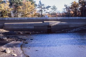
Background: Dolloff Dam is at least 176 years old as of 2018, according to a survey conducted by the Army Corps of Engineers in 1978. Over the years it has seen many improvements and repairs. The stoplog section was added to the dam in 1956 in place of a gated outlet at the same time the spillway was enlarged. In 1964, its upstream side was resurfaced with concrete and in 1970 a concrete walkway was built. In 1974, the dam was again rehabilitated and the stoplog section was reconstructed.
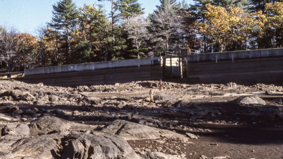
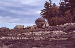
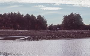
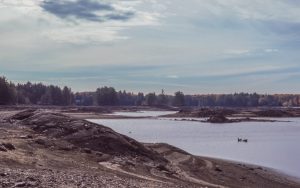
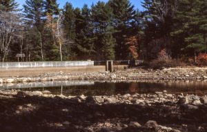
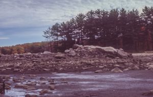
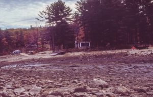
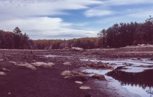
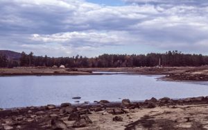
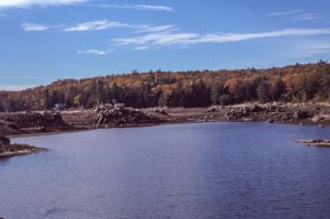
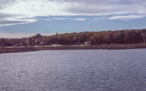
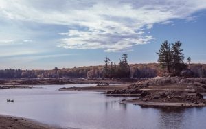
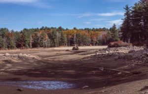
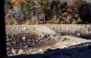
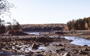
Forward to more recent times: By 1985, further repairs had become necessary. In order to conduct the repairs, the level of water in Pawtuckaway Lake had to be dropped drastically so that work could be accomplished on dry land. In the fall of that year, therefore, the usual drawdown of the lake continued until most of the water was drained off by October. This left an eerie landscape that was captured in photographs by former Pawtuckaway resident George Robinson, among others. George offered his photos to the Nottingham Historical Society and member John Bartsch transferred the images from slides to digital pictures. Courtesy of George, John, and the Nottingham Historical Society, we are pleased to be able to share this wonderful view into the past with the visitors to our website. Enjoy!
For those of you who may have your own memories of this historic event, we would love to hear from you. Needless to say, if you have photos of the lake during or after it was drained that you would be willing to share as well, we will be delighted to post them on the website. Just send us an email at: Info@PawtuckawayLake.com and if applicable, attach your pictures. Maybe we can create a new Photo Gallery to add to our permanent collection of photographs of Pawtuckaway Lake on this website. And thanks!
Great pictures!- thank you so much for sharing this! I was there and kick myself for not taking pictures. Don’t know why I didn’t. There were some old outboard, anchors caught in rocks, propellers, but it was funny, I never found a single smart phone.
I remember a small house on the end of the dam that had a sign on it that said: “Protected by gas bomb thief trap”. Never saw any signs of anyone living in it. That was in the late 40’s. Jack.
Like Jonathan, I too remember this event. Exploring the bottom of our lake that Fall was quite an adventure.
These pics are great! But are there larger versions of the images available somewhere online? I’d like to zoom in a bit, to see more of the detail.
Thank you to those who did the legwork on this project.
// Jack Hodgson
Hi, Jack;
You should be able go the Photo Gallery on this website (in the Menu under PHOTOS). It has a category called “1985 Lake Drawdown”, which I think has all the same pix. Clicking on each image should isolate it on your screen in a larger format. Try that!
I remember, in the late 40’s there was a small house on the dam that had a sign on it that said: “Protected by gas bomb thief trap.
Hi, Jack;
Do you think it’s the same as the small house that appears at the end of the dam in the 1918 photo of Dolloff Dam?